- Project Size: 2,724 hectares
- Orogenic Gold in Established Placer District
- Property geology analogous to the Juneau Gold belt which hosts 7,000,000 oz Au of historical production
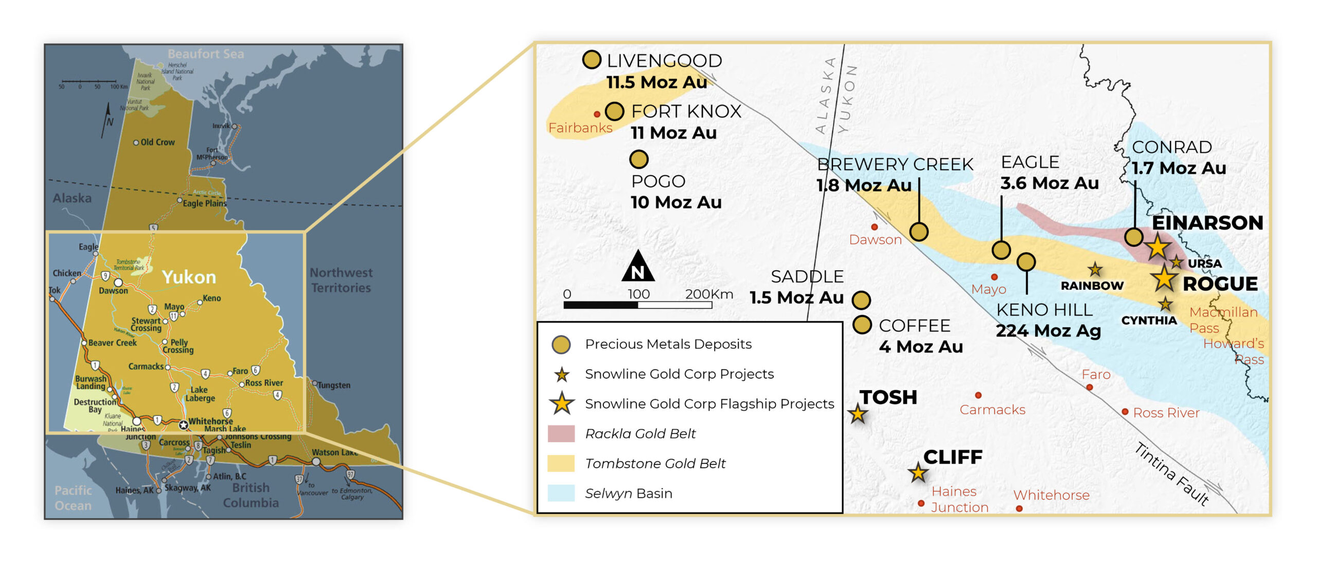
The Cliff Gold Project covers a series of pronounced gold-in-soil anomalies in the Yukon’s Ruby Range, a prolific placer gold district with more than a century of placer gold production. The Project is underlain by Kluane schist and exposures of the Ruby Range batholith. These units correspond in age, lithology and structure to host rocks of the rich Juneau Gold Belt to the southeast, which has produced over seven million ounces of orogenic gold.
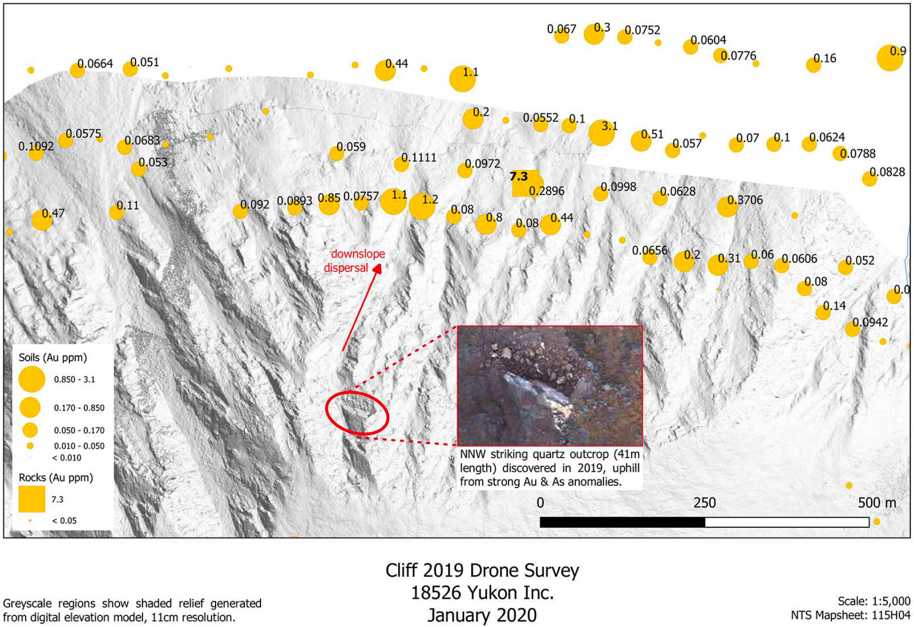
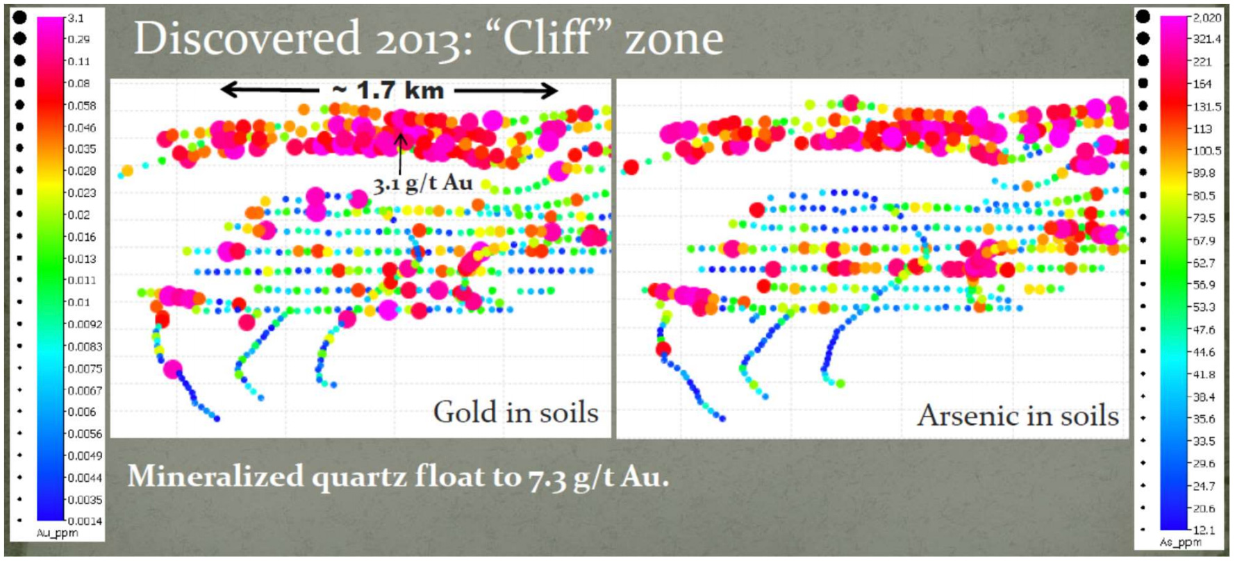
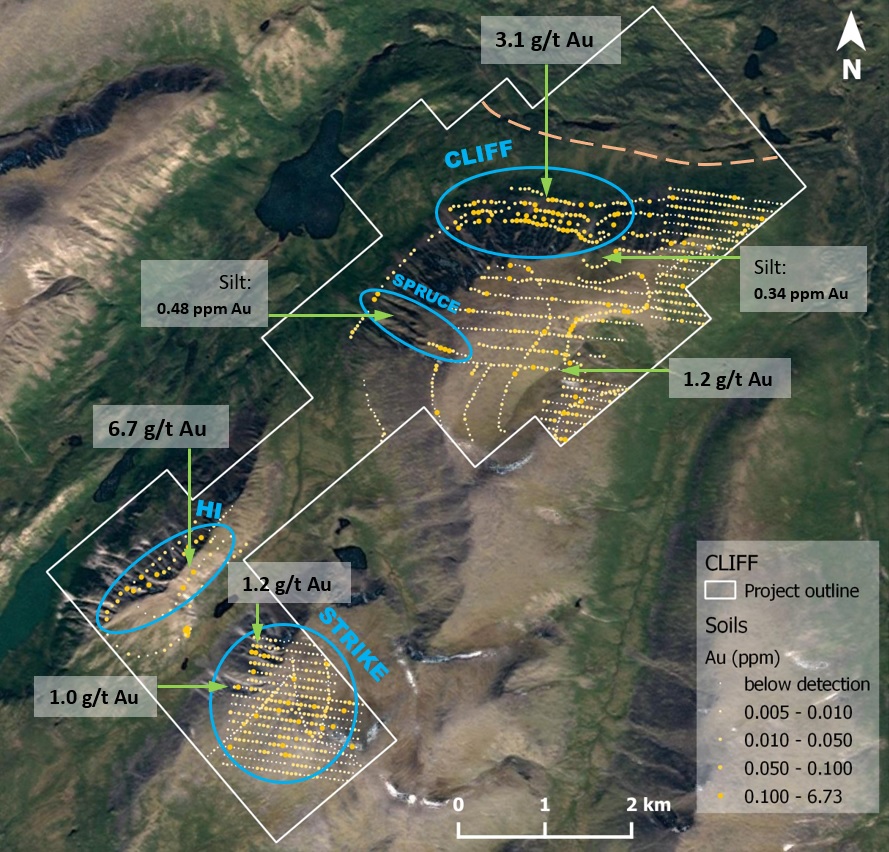
Systematic soil and talus sampling over Cliff identified a large, consistent gold in soil anomaly averaging 179 ppb Au and over an area of 1,600 by 300 metres, adjacent to a significant fault zone. The highest-grade soil sample from this anomaly was 3.1 g/t Au. A single grab sample of quartz-carbonate float assayed 7.3 g/t Au. The Company will conduct follow-up prospecting and mapping this summer. High-resolution drone imagery suggests the presence of parallel northwest-trending structures that may control gold mineralization.
In addition to the “Cliff” zone, 3 additional targets we staked in early 2021.
- The “Hi” zone is a 1.4 km long zone of elevated soils and talus fines over an exposure of the Ruby Range batholith. Eighteen of 44 historical soil samples in this area returned values above 40 ppb Au, to a maximum of 6.8 g/t Au.
- The “Strike” zone is a 1.5 x 1.5 km area with variably anomalous gold and arsenic in historical soils and talus fines to a maximum concentration of 1.26 g/t Au along the contact of the Kluane schist and the Ruby Range batholith.
- The “Spruce” zone has historic stream sediment samples up to 0.46 g/t Au that are downslope from soil samples up to 0.5 g/t Au.
The Cliff property is situated within 13 kilometres of existing placer roads, 34 kilometres of a 30 MW hydroelectric station, and 40 kilometres of the town of Haines Junction, Yukon